Only complete the projects that are assigned in your unit. Please check with Mrs. Wilt first if you do not find project directions listed here for a specific assigned project.
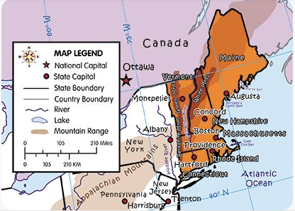
Map Drawing of New England States
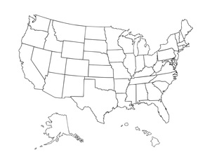
Prior to this project, print the blank United States Map.
Informational website:
A variety of geographical games can be found at: http://kids.nationalgeographic.com/kids/
Please check out some games.
Return to this site as you move through the unit for enrichment time each day at the end of the school day.
Look at maps from early in the history of the US, and those of today. The Library of Congress website has a whole series of early United States maps available for viewing. They can be found at: http://memory.loc.gov/ammem/gmdhtml/
Interactive map with geographical features as well as states:
http://www.learner.org/interactives/historymap/sea_game.html
Objective:
- Locate and label the New England region on the U.S. Map.
- Color the New England region orange.
- Write the name of each of the New England region states on the map in black.
- Label each state capital with a red circle.
- Label the ocean to east of the New England states with blue.
- Label the country that is located to the north of the New England states with purple.
- Label the river that forms the border between New Hampshire and Vermont with blue.
- Color the Berkshire, Green and color the White Mountains with brown
- Check your map before submitting.
- Take a PEEK.
